


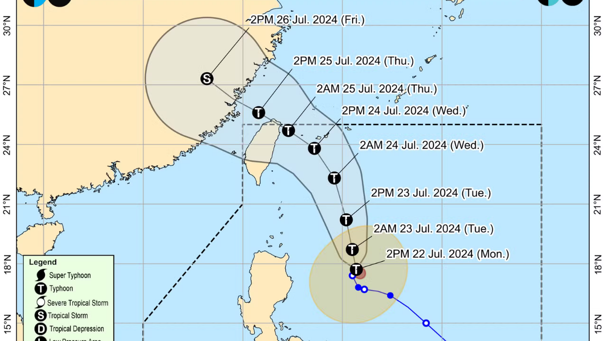


MANILA, Philippines – State weather bureau has raised Carina from a tropical cyclone to a supertyphoon after gaining further strength Wednesday afternoon as it heads for a landfall in Northern Taiwan.
In its 5 pm bulletin, the Philippine Atmospheric Geophysical and Astronomical Services Administration said Carina was spotted 380 kilometers north of Itbayat, Batanes in the northernmost part of the Philippines, heaving northwestward at 20 kilometers per hour (kph).
The super typhoon packs maximum sustained winds of 185 kph and gustiness of up to 230 kph.
Once Carina makes landfall in Taiwan, it can weaken back into a typhoon category and eventually fully exits the Philippine Area of Responsibility.
Signal number 2 is still up in the province of Batanes while signal number 1 is raised in Babuyan Islands, northern portion of mailand Cagayan and northern portion of Ilocos Norte.
While Carina is far from Metro Manila, it enhances the southwest monsoon causing heavy rains in the National Capital Region where red rainfall warning has been raised.


